Additional information and illustrations to the brochure “Geological Features of Castlemaine”
———————————————————————————-
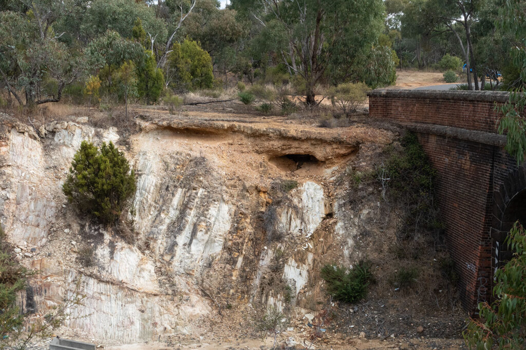
Ordovician Sedimentary Rocks
Hard Hill (Chewton railway cutting). Many features of the Ordovician base rock can be seen in the cutting.
Photos by Euan Moore.


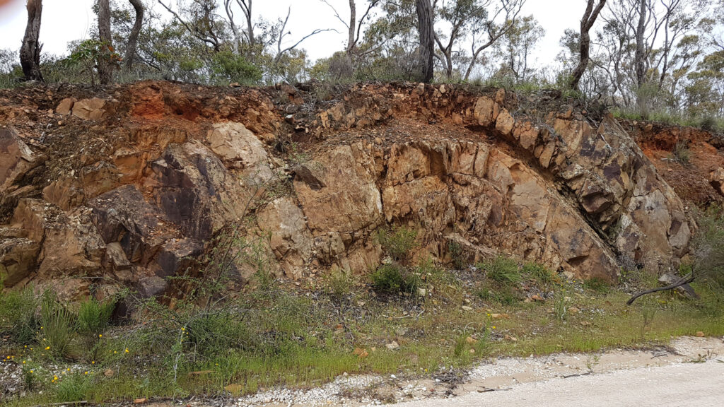
One of several anticline outcrops to be found in cuttings around Castlemaine and surrounds, this one is easily seen on the Kalimna tourist road, 200 m north of Hunter Street on the east side of the cutting. A fault, with a movement of a few centimetres is at the left of the fold.
Photo by Jenny Rolland
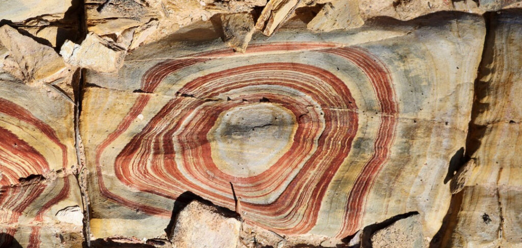
Among superficial effects in the weathered zone, Liesegang rings may form due to groundwater percolating through porous sandstones and evaporating at the surface leaving ferruginous salt deposits.
Photo by Cathrine Harboe-Ree
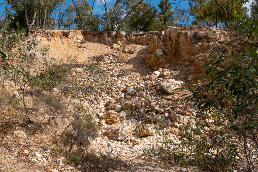
Quartz Reefs
Eureka Mine.
The worked out cutting contained gold, said to have been visible at the surface. The reef was later worked below ground level for quartz only.
Although gold is associated with quartz reefs, massive quartz, like the boulders in the foreground, is often barren or of very low grade.
Photo by Euan Moore

.
Quartz Hill
About 2 km north of Chewton at the head of Sailors Gully, this reef attracted early attention, and in 1855 it was the first to be mined by a company. Adits were driven into the hill from the west, and a shaft eventually reached 400ft. It was very rich in gold in the early years, especially above the water table.
Photo by Euan Moore
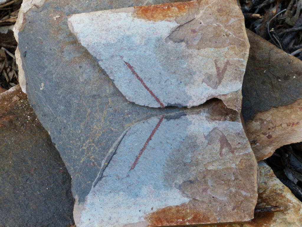
Graptolite fossils
Graptolites (incomplete) found in Kalimna Park
Both halves of the split rock are shown, with two species of Graptolite evident. The reddish stipe on the left is 35mm in length.
Photo by Noel Young
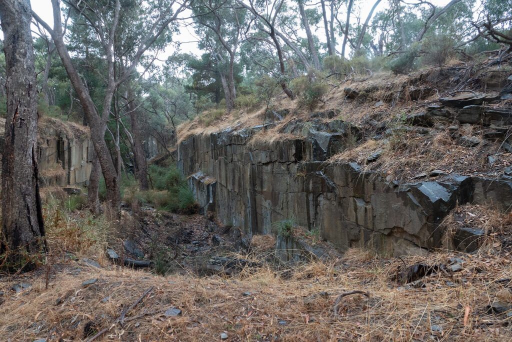
Slate
Slate quarry in Specimen Gully Road
The line of quarries extends for some distance from the road on both sides of the road. The quarry on the south has been used for art exhibitions and concerts. At one time Collins Street, Melbourne was paved with slate from these quarries.
Photo by Euan Moore
One of several abandoned slate quarries east of Golden Point Road. They are close to the metamorphic aureole.
Photo by Noel Young

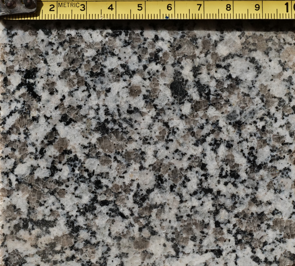
Devonian Granodiorite
Weathering of granitic rocks commonly results in rounded Tors and boulders on ridges, such as this example on Mount Alexander.
Photo by Noel Young

..
Polished surface of Harcourt Granodiorite from quarries at the foot of Mount Alexander which produced decorative stone.
Intrusive magma deep underground cools slowly, allowing large crystals to grow. Felspar, the major constituent is white, grey is quartz, and minor “mafic” minerals are black.
Photo by Noel Young
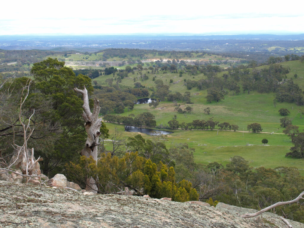
Metamorphic aureole
View south west from Mount Alexander. The granodiorite in the foreground extends across to the freeway cutting which runs N-S along the near side of the ridge. The ridge is formed by more resistant metamorphosed Ordovician rock at the granodiorite contact.
Photo by Noel Young
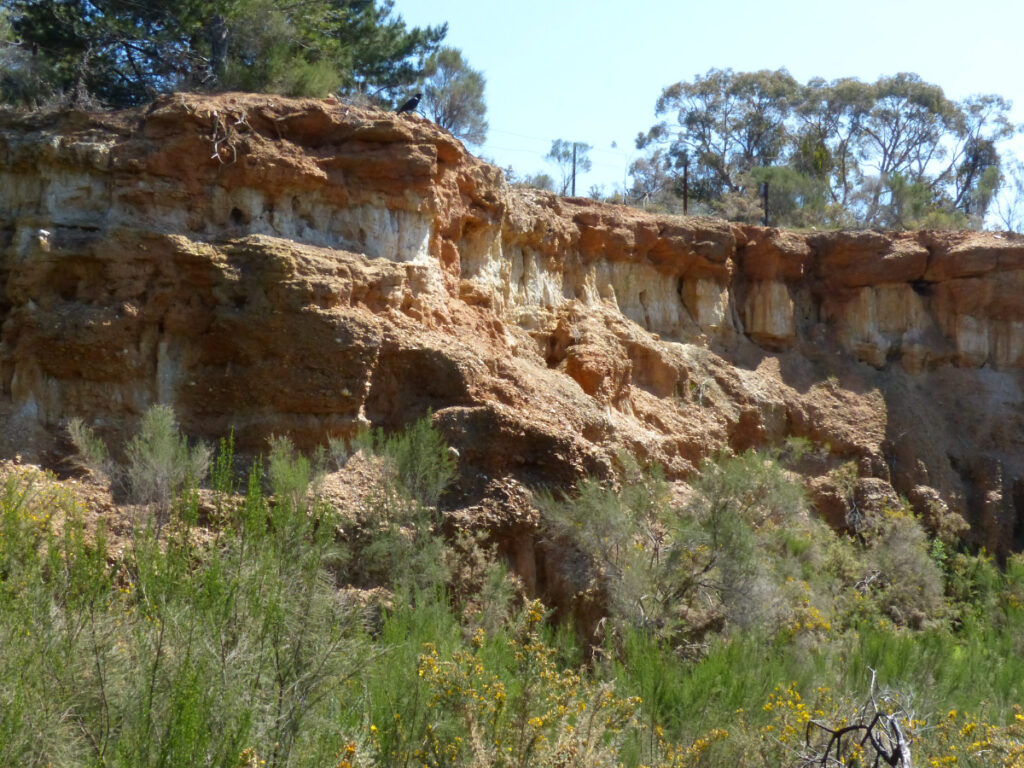
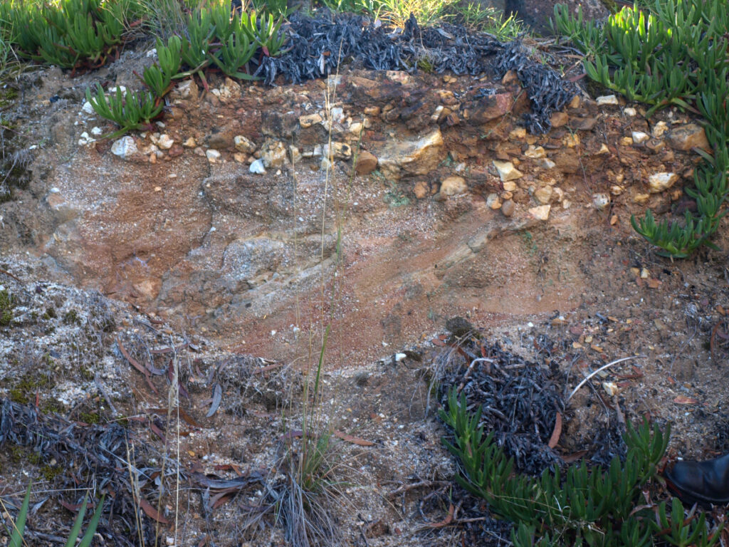
Cenozoic river alluvium
Extensive remnants of alluvial sediments overlying the Ordovician base rock contained disseminated gold and were mined by blasting with high pressure water jets (sluicing), or (where applicable) dredging. Examples of sluiced remnants shown below are at Red Knob, Vaughan, and Red Hill, Chewton.

In Castlemaine examples of smaller remnants occur on hill tops, such as the Kennedy street road cutting and Lushington Hill basal conglomerates. The latter show some tunnelling at the contact by gold seekers.
Photos by Noel Young.
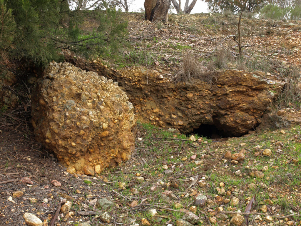
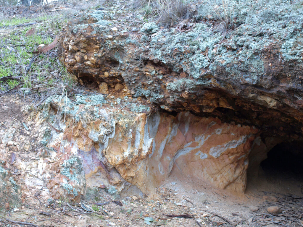
There are many cases where Cenozoic river valleys contained alluvium with accumulated gold in the basal gravels. Some of these valleys were later capped by lava flows of the Newer Volcanic Group. Seeking out these preserved valleys by miners tunnelling under the basalt or sinking shafts through the cap was known as “deep lead” mining.
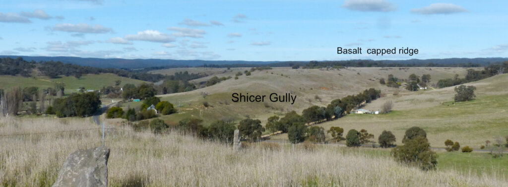
There is evidence of deep lead tunnelling along Shicer Gully east of Guildford.
Photo by Noel Young.
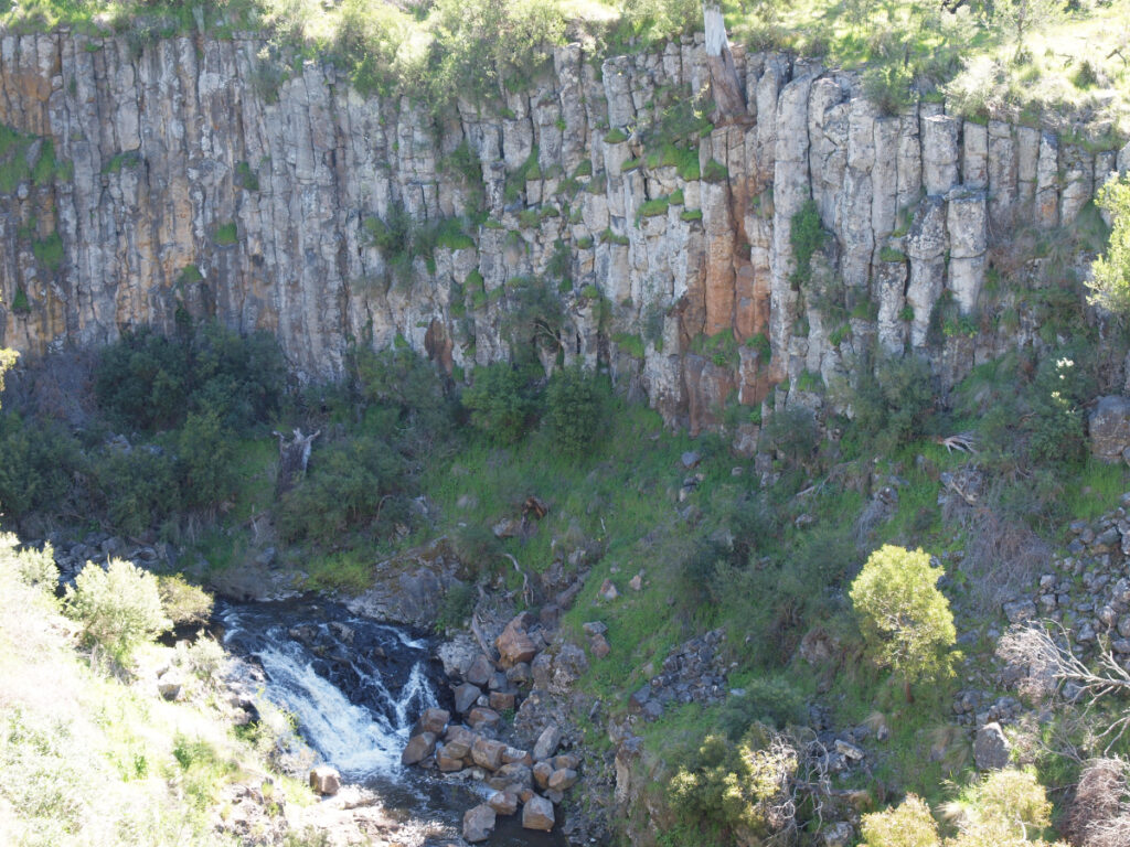
Basalt lava flows
Extensive vulcanism occurred in south-west Victoria from Pliocene to Holocene times. The region around Castlemaine is at the northern extremity of this area, but evidence is not hard to find of both valley flows and ash cones. The most extensive cover from “shield” extrusions forms the Moolort Plains west of Cairn Curran, and extends continuously south to Ballarat.
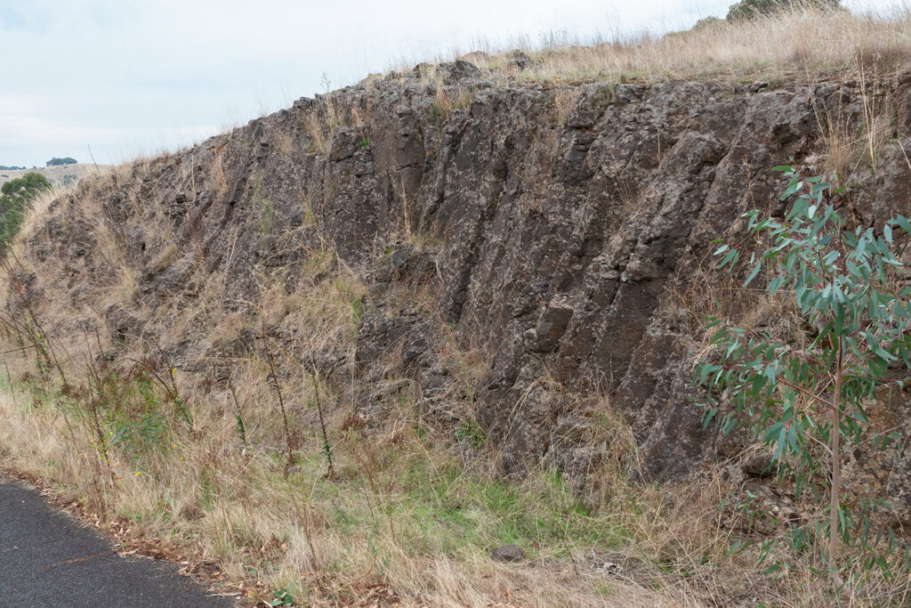
Examples of columnar jointing in flows of basalt.

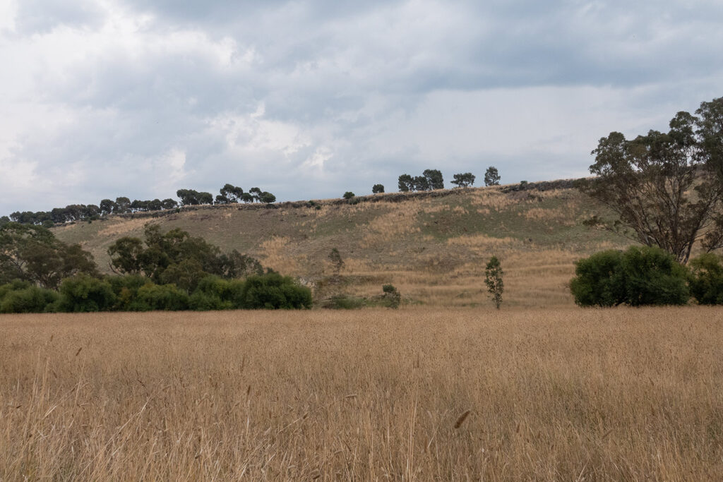
Examples of Basalt lava flows after subsequent erosion, leaving the resistant basalt as a prominent cap.
The Muckleford Creek in its lower reaches was over-run by a lava flow. It is now a “lateral stream” with Ordovician base rock visible to the west (photo 1 foreground) and the cap visible to the east of the creek. This is an extension of the Guildford Plateau basalt – photo 3 shows the capped plateau from the Loddon River side near Guildford.


Mt Franklin on the Castlemaine – Daylesford road is an extinct volcano covered with Pine trees. The crater, visible in this aerial photo, is accessible by road and is used as a camping ground.
Photo by Noel Young

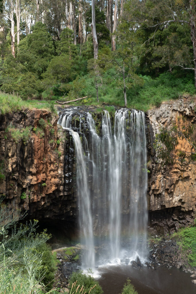
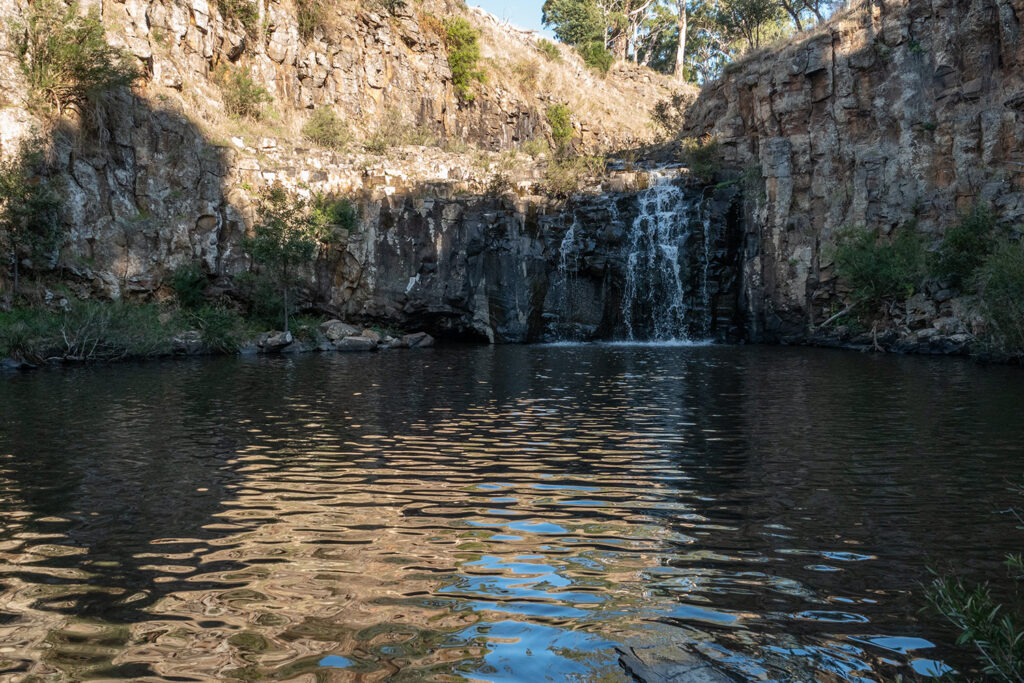
Waterfalls
Most waterfalls in the area are due to headward erosion of streams into basalt lava flows. The basalt breaks away on vertical column joints. Other rock types are more likely to suffer graded erosion resulting in rapids or cascades rather than falls.
Trentham Falls on the Coliban River
Water erosion below the falls has eaten into the underlying Ordovician rock leaving an overhang.
Photo by Euan Moore
.
Loddon Falls near Glenlyon.
Photo by Euan Moore
.
The Cascades, Metcalfe
Here the Coliban River runs through Devonian granodiorite near the south-eastern extremity of its outcrop. The exposure of Devonian is seen on a geology map as a horse-shoe shape extending from here as far as Big Hill near Bendigo, and curving back to Maldon in the west.
Photos by Noel Young

