Our club has a number of projects that our members can get involved with. These revolve around the recording and study of the natural environment of our region. Please contact the club – castlemainefnc@hotmail.com – if you would like to be involved with any of these projects.
Recording your Observations
Recording your observations contributes to the knowledge of our natural environment and helps us protect the remaining natural areas in the region. Our ‘Recording Observations‘ page provides some information on how to do this. In addition you can submit your observations via our club email castlemainefnc@hotmail.com for publication in our newsletter and at our meetings.
Great Southern Bioblitz
Since 2021 our club has taken part in the Great Southern Bioblitz on iNaturalist. This project engages citizen scientists to create a snapshot of biodiversity across the southern hemisphere with more than 200 groups from countries in Africa, South America and the Indo-Pacific taking part. Over a period of 4 days during spring our group records as many sightings as possible across Mt Alexander Shire and in the eastern half of Hepburn Shire.
You don’t have to be a member of our club to take part. Anyone who is interested can make observations during the Bioblitz period and load them to the iNaturalist platform where they will count in the Great Southern Bioblitz. You can read more about how to contribute to the next Great Southern Bioblitz and see an analysis of our results in previous years on our Great Southern Bioblitz page.
During the Great Southern Bioblitz weekend we organise events where you can learn more about our local environment and collect observations for the Great Southern Bioblitz. These events will be advertised at meetings and via our regular posts.

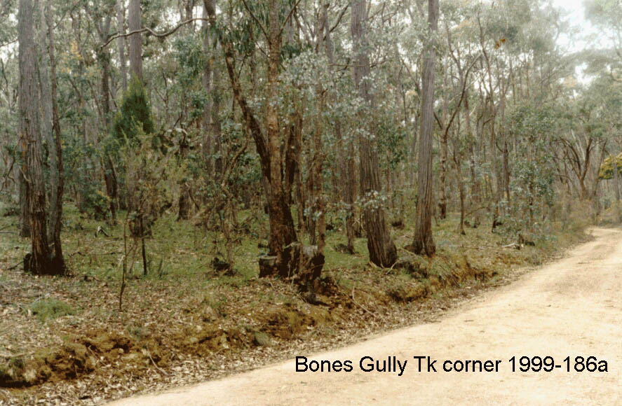
Photopoint Project – recording the changing landscape
The CFNC Photopoint Project commenced in the late 1990s with the goal of monitoring the changing condition of vegetation at multiple locations in the Mount Alexander Shire through repeat point-location photos. Over the following years, more than 1600 photos from over 970 locations were collected, covering a wide variety of habitats and vegetation types. Documentation for each photo included date, GPS coordinates, direction, site type and relevant recent activity (eg burns, floods, firewood collection, plantings). Club members Ern and Leslie Perkins were instrumental in setting up this project and most of the photos were taken by Ern.
The photos provide a valuable historical record as well as the basis for important long-term documentation of changes following burns (see example below), weed control and revegetation. The intention was that photos would be repeated about every 10 years. In 2013 the collection was digitised and a CD was prepared with the assistance of Connecting Country, providing an excellent searchable database.
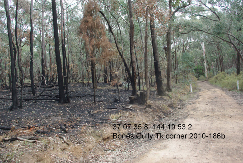
2010 Shortly after a planned burn
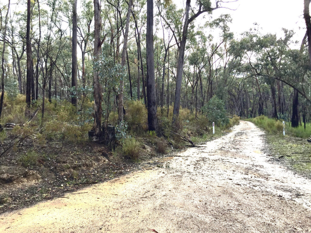
2020 Post-burn regrowth of Eucalypts, wattles and Cassinia
Vegetation Surveys
In addition to the valuable plant lists and photos collected by club members on excursions into the bushlands of the Castlemaine region, it is also important that long-term systematic vegetation surveys are made to monitor populations of rare plants and evaluate the effects of climate and changes in land management practices, especially planned burns, on different vegetation communities. To this end, in the 1990’s, club members Ern and Leslie Perkins established 115 quadrat sites in the area for detailed and systematic repeat recording of plant species and their condition. Assisted by other club members, these quadrats were surveyed regularly over many years, revealing important information on plant species location, post-fire recovery and other topics, as recorded in many issues of the Castlemaine Naturalist (see the ‘Newsletters’ page on this website).
Realising the critical importance of making these records available for government and private land managers, Ern commenced the task of entering the quadrat survey records into the Victorian Biodiversity Atlas, the dataset used in the government’s environmental decision-making. Currently the club is updating the quadrat survey data in the VBA and is reviewing quadrats for ongoing repeat surveys. As Ern said, “Working on a quadrat is interesting, and gives a new perspective on our bushland. It also helps in learning to identify plant species.”
The Fryerstown Grevillea, G. obtecta, is restricted to a small area near Lauriston and to the forests on Fryers Ridge and Porcupine Ridge. Members are helping with vegetation surveys for this species.
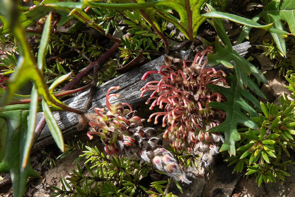
Photo: Euan Moore
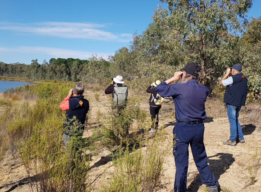
Bird Surveys
Regular collection of data for bird species and numbers using a standardised method and storage in a national database accessible by all, provides not only valuable information for field naturalists but an essential resource for environmental assessment. Long-term trends for both bird numbers and species can be established and relationships with changes in climate and land management recorded.
CFNC members conduct regular bird surveys at 14 different sites around the Mount Alexander Shire. These sites were established by Ern and Leslie Perkins and monthly records for some go back as early as 1988. All records are entered into Birdata, a national database maintained by Birdlife Australia. A standard survey technique developed by Birdlife Australia is used i.e. a 20 minute/2 hectare survey. New volunteers to assist with these surveys are welcome.
Castlemaine Field Naturalists Club members have been involved in the Annual Challenge Bird Count for more than 20 years. You can read more about the most recent event and what was seen click here. See our Calendar for the next Challenge Bird Count dates.
Flora Guides
Our website Castlemaine Flora (Wild Plants of the Castlemaine District) provides detailed information about many of the native plants in our region. In addition to this website, the club has plant lists for many of the conservation reserves in the region. These resources require ongoing updates as plant names change or additional species are found in these reserves. People with botanical knowledge can assist by reporting additional plants for these lists. See ‘Recording your Observations’ above.
Castlemaine Botanic Gardens Weed Removal
The Castlemaine Botanic Gardens support many threatened flora and fauna species, especially in the Nature Reserve, an area of remnant native vegetation in the north-west corner of the gardens. Removing weeds from this area helps native species prosper.
In 1989, a population of the threatened Eltham Copper Butterfly was discovered in the Nature Reserve, but Broom and other weeds were placing this population at risk by reducing the quality of the vegetation, especially the host plant for the butterfly, Sweet Bursaria, Bursaria spinosa. Over a number of years, club members worked hard in regular field days, removing weeds and planting Sweet Bursaria. The Eltham Copper Butterfly survives in the area in small numbers, monitored by club members and other volunteers. More information on this rare butterfly prepared by Connecting Country can be found here.

For many years, CFNC members have also been involved in a program led by member Margaret Panter to remove invasive needle grass weeds from the lower section of the Nature Reserve, west of Barkers Creek. Volunteer working bees were held from late spring to early autumn. In 2023, this work was passed back to council staff. There are several species of needle grass and related stipoid weeds in our region and it is important to distinguish these from native grasses such as Austrostipa spp. Information about how to distinguish between needle grasses and native grasses is available here.